


The best road trip apps for 2026 are
- Google Maps (For navigation),
- the official NPS App (for national parks),
- GasBuddy (for fuel prices),
- Roadtrippers (for route planning with stops),
- AllTrails (for hiking), and
- Recreation.gov (campsite and permit booking).
But no single app covers everything; most experienced road trippers run a stack of four or five apps that each handle one job well, from finding the cheapest gas to downloading offline trail maps before you lose signal in the backcountry.
This guide breaks down the best app for every part of a road trip or national park vacation, so you can build a stack that actually works together instead of scrolling through App Store reviews the night before you leave.
Planning the whole trip, not just the apps? Start with our US National Parks Road Trip Guide and how to plan a road trip for the full itinerary framework.
Quick Answer: Best Road Trip Apps at a Glance
Category | Best App | Why It Wins |
Overall navigation | Google Maps | Reliable offline maps, live traffic, up to 10 waypoints |
Real-time hazards | Waze | Crowdsourced police, accident, and speed-trap alerts |
Route planning with stops | Roadtrippers | Finds scenic detours and attractions along your route |
National parks | NPS App (official) | Offline park maps, ranger-led audio tours, alerts for 400+ parks |
Hiking & trails | AllTrails | Trail conditions, difficulty ratings, offline trail maps |
Gas prices | GasBuddy | User-reported prices at 150,000+ US stations |
Campgrounds & permits | Recreation.gov | Official booking for federal campsites, timed-entry permits |
Free/dispersed camping | iOverlander | Crowdsourced free campsites and overnight parking |
Roadside assistance | AAA Mobile | Tow requests, battery jumps, fuel delivery from the app |
Audio storytelling | Autio | Location-triggered narrated stories along your route |
Why the Right App Stack Matters for National Park Road Trips
National park road trips add layers most city trips don’t have: no cell signal for hours at a stretch, timed-entry reservations, permit systems, and routes where the “shortest” path on a map isn’t always the smartest one. Downloading the right apps and their offline data before you leave cell coverage is one of the most overlooked steps in planning a national park trip, right up there with budgeting for what a national park trip actually costs.
Below, apps are grouped by job: getting there, navigating inside the park, saving money, booking a place to sleep, and staying safe.
Best Navigation & Route Planning Apps
1. Google Maps — Best Overall
Google Maps remains the most dependable all-around navigation app for road trips, combining live traffic, satellite imagery, lane guidance, and downloadable offline maps that still show labeled roads, businesses, and points of interest with zero signal. It supports up to 10 waypoints per route, which is usually enough for a multi-park loop.
2. Waze — Best for Real-Time Hazards
Waze leans on crowdsourced reports from other drivers to flag accidents, police activity, and road hazards, then reroutes around them faster than most standard mapping apps. Many road trippers run Waze on the highway and switch to Google Maps once they’re off the interstate and looking for restaurants, trailheads, or gas near their destination.
3. Roadtrippers — Best for Planning the Journey (Not Just the Destination)
Roadtrippers is built specifically for road trips: you plot a start and end point, and it surfaces scenic byways, roadside attractions, and detours along the corridor, not just the fastest route. It’s the app of choice when the drive itself is part of the vacation, a natural pairing with a fall national parks itinerary where the goal is slow, scenic driving rather than the shortest time on the road.
4. Wanderlog — Best for Collaborative Trip Planning
If more than one person is contributing to the itinerary, splitting stops, sharing a budget, or voting on detours, Wanderlog’s shared, collaborative trip boards make group planning easier than passing around a spreadsheet.
Best Apps for National Parks Specifically
5. The Official NPS App — Essential, Not Optional
The National Park Service’s own app covers more than 400 park units nationwide with interactive maps, self-guided audio tours, real-time alerts, and full offline downloads for each park a genuine necessity given how unreliable cell service is inside most parks. According to the National Park Service, the app also includes amenity information (restrooms, food, transportation) and accessibility features like audio-described points of interest.
How to use it correctly: open the app before you lose signal, search your park, and toggle “Download for Offline Use.”the download is large, but it’s the difference between a working map and a blank screen once you’re past the entrance station.
6. AllTrails — Best for Hiking & Trail Conditions
AllTrails pulls recent user reviews, photos, and trail conditions so you know if a trail is muddy, snowed in, or closed before you commit to it. Downloading a trail map for offline use here is worth pairing with a well-fitted daypack; see our guide to the best travel backpacks for hiking national parks if you’re outfitting for multi-day hikes.
7. Recreation.gov — Best for Campsites & Timed-Entry Permits
Recreation.gov is the official federal booking system for campgrounds, backcountry permits, and the timed-entry reservations now required at several high-traffic parks during peak season. If your trip revolves around fall colors, cross-check the timing against a fall foliage forecast before you lock in permit dates; foliage windows shift year to year.
Best Money-Saving Apps for Road Trips
8. GasBuddy — Best for Fuel Prices
GasBuddy crowdsources gas prices from over 150,000 stations across the US and is consistently cited as the most reliable free tool for finding the cheapest fuel along your route, with price-prediction and cashback features on top of the basic price map.
9. A Rewards Travel Credit Card App
This isn’t a road trip app in the traditional sense, but pairing a gas-rewards or travel credit card with your fuel-price app stack can meaningfully cut trip costs; see our breakdown of the best travel credit cards for options that earn extra points on gas and lodging.
10. iOverlander — Best for Free & Dispersed Camping
iOverlander is a crowdsourced database of free campsites, overnight parking spots, and dispersed camping areas, built and maintained by other road trippers and van-lifers rather than a company. It’s especially useful on the drive between national parks, where paid campgrounds may be scarce or fully booked.
Best Apps for Comfort, Safety & Entertainment
11. AAA Mobile — Best for Roadside Assistance
The AAA Mobile app lets members request a tow, jump-start, or fuel delivery directly from their phone with GPS-based dispatch, which matters most in the exact places national park road trips tend to go: remote, low-signal stretches of highway.
12. Autio — Best for Location-Based Audio Stories
Autio plays short, narrated stories tied to your GPS location history, folklore, and trivia about the towns and landmarks you’re driving past, turning long highway stretches into something closer to a guided tour than dead air.
13. GoodSam / Roadtrip-specific weather apps
A dedicated weather radar app (beyond your phone’s default) is worth having for mountain and desert parks, where conditions can shift fast; check it alongside your fall foliage forecast planning for the clearest picture of when to go.
14. A Connectivity / eSIM App
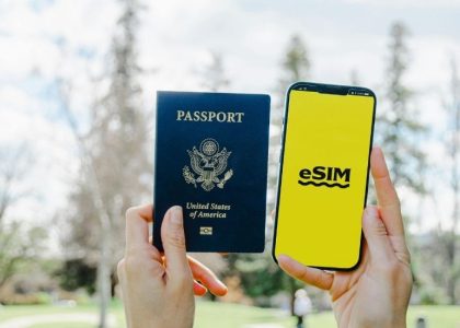
Cell coverage drops fast once you’re off the interstate and into park territory. A US-focused eSIM lets you add data on the fly without hunting for a physical SIM card at a gas station; see our full comparison, Best eSIM for USA Travel: Tested & Compared (coming soon).
15. A Packing-List App or Checklist
Before you load the car, run through a proper checklist rather than relying on memory; see The Ultimate Road Trip Packing List (Free Checklist) (coming soon) for exactly what to bring for national park driving specifically.
How to Build Your Road Trip App Stack (By Trip Type)
- Weekend national park trip: Google Maps + NPS App + AllTrails + GasBuddy
- Cross-country multi-park road trip: Google Maps + Waze + Roadtrippers + NPS App + Recreation.gov + GasBuddy
- Budget/dispersed camping trip: Google Maps + iOverlander + GasBuddy + AAA
- Family road trip: Google Maps + Roadtrippers + Autio (for the kids) + AAA
Whatever the mix, download offline maps for every app in your stack before you leave home or your last spot with reliable Wi-Fi, not at the trailhead.
FAQs: Best Road Trip Apps
What is the best app for national park road trips?
The official NPS App is the essential app for any national park visit; it’s free, covers 400+ parks, and works fully offline once downloaded. Pair it with Google Maps for the driving portion and AllTrails for hikes.
Does Google Maps work offline in national parks?
Yes, if you download the map area in advance. Offline Google Maps still shows labeled roads, points of interest, and turn-by-turn directions, but it won’t have live traffic or search results for anything outside the downloaded region. Download before you enter the park, not after you lose signal.
Are road trip apps free to use?
Most of the apps in this guide Google Maps, Waze, GasBuddy, the NPS App, iOverlander, and AllTrails’ basic tier are free. Roadtrippers, AllTrails Pro, and some premium planning apps offer paid tiers with extra features like advanced route optimization or unlimited offline downloads.
What app tracks the cheapest gas prices?
GasBuddy is the most widely used app for this, drawing on user-submitted prices from more than 150,000 stations nationwide.
Do I need a separate app for booking campgrounds?
For federal campgrounds and national park permits, yes, Recreation.gov is the official booking system. For private campgrounds, apps like The Dyrt or Hipcamp cover ground Recreation.gov doesn’t.
Can I use one app for everything on a road trip?
Not really; no single app combines reliable offline navigation, national park data, gas prices, and campsite booking at a professional level. Most experienced road trippers use a stack of 3–5 apps, each specialized for one job.
What’s the best app for planning a road trip with multiple stops?
Roadtrippers and Wanderlog both specialize in multi-stop route planning with attraction discovery along the way, which works better for scenic road trips than a standard point-to-point navigation app.



3 thoughts on “Best Travel Apps for Road Trips & National Parks”
Comments are closed.